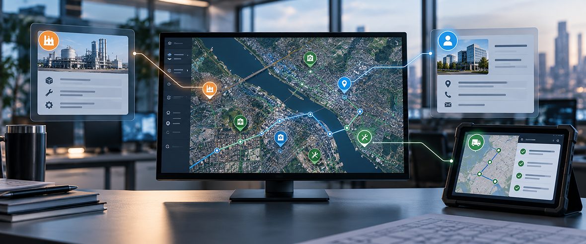
GIS consulting services increasingly begin with the same problem: location data trapped in a specialist tool. Most enterprises run GIS as a mapping system, siloed from the ERP, asset management, CRM and field operations platforms that make daily decisions. A field technician works from an outdated asset map while the maintenance system shows a different status, and no one catches the gap until the job goes wrong. Enterprise GIS integration closes it. It turns GIS from a mapping tool into an operational intelligence layer, feeding location context into the systems that run the business. This guide covers how, system by system.
Enterprise GIS integration connects geographic and location data with ERP, CRM and field operations systems so spatial context informs asset management, customer decisions and field workflows in real time.
What Is Enterprise GIS Integration?
Enterprise GIS integration connects geospatial platforms with core business systems, such as ERP, CRM, asset management and IoT, through APIs and data pipelines. It moves location data out of a standalone map and into the workflows where decisions are made. The difference is direction: data flows into and out of daily operations rather than sitting in an isolated analysis tool.
Integration turns coordinate data into operational insight, not just static maps.
Standalone GIS answers a spatial question when someone opens the map. Integrated GIS puts that spatial context inside the systems people already use, so a work order, a customer record or an inventory count carries its location automatically. That shift, from a tool you visit to a layer that informs every system, is what enterprise integration delivers.
Why Location Intelligence Needs to Reach ERP, CRM and Field Teams
Location data that never leaves the GIS team helps no one making operational decisions. Four gaps appear when spatial context stays siloed, and each has a direct business cost. They are the case for integration.
- Data silos slow cross-department decisions: when only the GIS team can see spatial data, other departments wait or decide without it.
- Field teams need live context, not static reports: a crew in the field needs current asset and location data at the job, not a report printed last week.
- Customer and asset records miss a geographic dimension: a record without its location is incomplete for routing, service or planning decisions.
- Disconnected systems drift out of sync: when GIS, ERP and CRM hold separate copies, teams work from inconsistent, outdated information.
The common thread is a decision made without the location context that would have changed it. Integration puts that context where the decision happens. The next three sections show what it looks like in ERP, CRM and field operations.
Also Read: Why Location Intelligence is Becoming a C-Suite Priority in Enterprises
How Enterprise GIS Integrates With ERP and Asset Management Systems
ERP runs the finance, inventory and procurement side of the business, while asset management systems run maintenance and work orders. Most of those assets exist somewhere physical. Connecting GIS to both ties each asset to its location, its maintenance record and its financial entry at once. The result is asset management that sees the map, the work order and the ledger together.
In practice, spatial asset data links to the records these systems hold, so a pipeline, pole or vehicle appears on an interactive map tied to its entries. Integration patterns with ERP systems such as SAP and asset management systems such as Maximo are well established, and they improve compliance and reporting by keeping one connected record rather than several. A utility, for example, can plan maintenance against assets it sees on a map, track their condition in the asset system and cost the work in ERP.
Clear ownership is what makes the integration work. GIS owns the asset location and spatial data. The asset management system owns maintenance status and work history. ERP owns the financial record, such as cost, depreciation and procurement. A shared asset ID links the same asset across all three, so each system reads the others without duplicating or overwriting what it does not own.
How Enterprise GIS Integrates With CRM Systems
CRM holds the customer, and every customer has a location that shapes how they are served. GIS-CRM integration adds that geographic dimension to customer data. It turns a list of accounts into a map of territories, service areas and opportunities.
Geocoding customer addresses supports territory and service-area mapping, while location-based segmentation informs site selection and market expansion. Enriching customer records with geographic and demographic context helps sales and service teams plan around where customers actually are. Field sales and service routing then runs from CRM data with location built in. A retailer weighing a new store, for instance, can overlay customer density on candidate sites rather than guessing. Location turns customer data from a list into a decision tool.
How Enterprise GIS Integrates With Field Operations
Field operations is where integrated GIS earns its keep, because the work happens at a location. Mobile GIS puts the map and the data in the hands of the crew. Done well, it works even where the network does not.
Mobile GIS apps let field teams work from the latest downloaded data offline and capture updates with GPS on site. When connectivity returns, the app synchronizes those updates with the central system. When two edits conflict, a defined rule resolves them, such as last-write-wins or flagging the conflict for a supervisor to review, so field and office changes do not silently overwrite each other. Working from current downloaded data, rather than a static report, speeds issue response, since the crew sees the latest state of the asset it is dispatched to. For field work, that connected view is the difference between a wasted trip and a first-time fix.
Case Study: ArcGIS: Digitizing Land Revenue Management with Modern GIS Software
The Architecture Behind Enterprise GIS Integration
The integrations above depend on an architecture that most organizations underbuild. Dashboards are easy to stand up, while the connective layer beneath them is where projects succeed or fail. Four architectural elements carry an enterprise-scale integration.
- APIs and integration layers: the connective tissue linking GIS to ERP, CRM and field systems, so data moves without manual export.
- Real-time and batch synchronization: the right sync pattern per data type, real-time where decisions depend on it and batch where they do not.
- Governance and access control: clear data ownership and access rules so integrated data stays consistent across teams, with multi-tenancy used where business units need isolation.
- Hosting chosen to requirements: cloud, on-premise or hybrid hosting selected by data residency, scale and security needs, not a fixed default.
Most GIS programs deploy dashboards and stop, missing the architecture that keeps data in sync. A dashboard over disconnected systems shows a snapshot that is wrong by the afternoon. Investing in the integration and governance layer, which a GIS strategy and GIS modernisation effort should prioritize, is what makes location intelligence reliable rather than decorative.
Real-World Use Cases for Integrated Enterprise GIS
Integration pays off differently by industry, and concrete cases show where. Each pairs GIS with the systems and data that matter for that sector. The four below span common enterprise contexts.
- Utilities: asset management and digital-twin foundations: GIS integration provides the spatial foundation for a digital twin, which also needs live sensor data and modeling to support maintenance planning and outage response.
- Logistics: dynamic route optimization: GIS plus IoT and field data reroutes around conditions in real time, cutting miles and delivery time.
- Retail: site selection and expansion: GIS plus CRM overlays customer density and demographics on candidate locations to guide where to open next.
- Public sector: cross-department data sharing: GIS plus ERP and CRM gives departments one shared spatial view for planning, permitting and response.
The pattern across all four is the same: GIS combined with operational systems produces a decision, not a map. A digital twin or a route optimization earns its place because it serves a clear business use, from maintenance to delivery. That business anchor is what separates a useful integration from a technology demonstration.
Common Challenges in Enterprise GIS Integration
The obstacles are consistent, which means they can be planned for. Most concern data and architecture rather than the mapping itself. The five below account for most stalled integrations.
- Legacy ERP and CRM with limited APIs: older systems expose little for integration, so connectivity has to be built or bridged.
- Inconsistent data formats and coordinate systems: mismatched formats and projections across platforms break the join before it starts.
- Dashboards without an integration architecture: a mapping tool over disconnected systems looks integrated but drifts out of sync.
- Missing governance: without ownership and sync rules, integrated data slowly diverges across teams.
- Field connectivity gaps: remote sites break real-time assumptions, so the design has to handle offline and sync.
None of these are reasons to avoid integration. They are reasons to design the data and architecture layer deliberately before deploying dashboards. An integration planned around these constraints holds together where one bolted on top of them does not.
When to Bring in GIS Consulting Services
Some integrations need specialist experience that internal GIS teams do not carry. GIS consulting services help design the integration architecture correctly the first time. The signs below indicate a program that would benefit from outside help.
- No dedicated integration architecture: GIS runs as a standalone tool with no plan for connecting it to ERP, CRM and field systems.
- Data drifting out of sync: ERP, CRM and GIS hold different versions of the same records, which points to a missing integration layer.
- Field teams on outdated maps: crews work from stale data because the mobile and sync architecture was never built.
GIS consulting services typically cover an as-is assessment, an integration architecture and roadmap, ERP, CRM and field system connectivity and ongoing governance support. Enterprise GIS solutions and implementation services are a way to design the integration correctly rather than a replacement for internal GIS ownership. The aim is a connected architecture the internal team can run.
How Successive Approaches Enterprise GIS Integration
GIS delivers its full value only when it is connected to the systems that run daily operations, from ERP and asset management to CRM and field tools. The integration architecture and governance matter as much as the mapping technology itself. Successive delivers this as a defined engagement in four stages: a current-state assessment of your systems and data, an integration design connecting GIS to ERP, asset management, CRM, IoT and field systems, a phased implementation that proves one connection before scaling, plus ongoing support that keeps the integration in sync. We apply GeoAI or digital-twin foundations only where a clear business use supports them. To find where your systems stand, assess your current GIS integration maturity before your next deployment.
FAQs
What is enterprise GIS integration?
It is the connection of geospatial platforms with core business systems such as ERP, CRM, asset management and IoT through APIs and data pipelines. It moves location data out of a standalone map and into the workflows where operational decisions are made.
How does GIS integrate with ERP and asset management systems like SAP and Maximo?
Spatial asset data links to the records these systems hold, so each asset appears on a map tied to its entries. Integration patterns with ERP systems such as SAP and asset management systems such as Maximo keep one connected record, with a shared asset ID linking location, maintenance and financial data across them.
How does GIS integration benefit CRM and customer data?
It adds a geographic dimension to customer records. Geocoding supports territory and service-area mapping. Location-based segmentation guides site selection and expansion, and sales and service routing runs from CRM data with location built in.
What role does GIS play in field operations and mobile workflows?
Field teams work from the latest downloaded data offline, capture updates with GPS and synchronize when connectivity returns, with a defined rule resolving conflicting edits. Working from current data speeds issue response and raises first-time fix rates over static reports.
What architecture is needed to integrate GIS with enterprise systems?
APIs and integration layers connecting GIS to ERP, CRM and field systems, real-time and batch synchronization by data type, plus governance and access control. Hosting and multi-tenancy are options selected by data residency, scale and security needs, not fixed defaults.
Which industries benefit from enterprise GIS integration?
Utilities use GIS with ERP for asset management and digital twins, and logistics uses GIS with IoT for route optimization. Retail uses GIS with CRM for site selection, while the public sector uses it for cross-department data sharing.
What are common challenges in GIS-ERP-CRM integration?
Legacy systems with limited APIs, inconsistent data formats and coordinate systems, dashboards deployed without an integration architecture, missing governance that lets data drift, plus field connectivity gaps that break real-time sync assumptions.
Can GIS integration work with legacy ERP or CRM systems?
Yes, though legacy systems with limited API support often need connectors or a middleware layer built to bridge them. An as-is assessment identifies where connectivity has to be built before the integration is designed.
How does GIS integration support digital twins?
GIS integration provides the spatial foundation for a digital twin by connecting asset location with maintenance and financial data. A full twin also needs live sensor data and modeling on top of that foundation. In utilities, it then supports maintenance planning and outage response where a clear operational use justifies it.
When should a company use GIS consulting services?
When there is no dedicated integration architecture, ERP, CRM and GIS data are drifting out of sync or field teams work from outdated maps. GIS consulting services design the integration architecture correctly rather than replacing internal GIS ownership.