
Forest E2E Management System
For AI-Driven Wildlife Incident Response
Wildlife incidents often begin with a phone call, but delayed routing, missing coordinates, and disconnected teams can slow every response. Forest E2E Management System converts citizen reports into structured, location-aware incidents and dispatches the nearest available ranger in seconds. With Hindi voice reporting, ArcGIS-based mapping, offline field access, and real-time control-room visibility, every incident moves through one connected response workflow.

Move From Unstructured Calls to Coordinated Field Response
Forest E2E Management System gives citizens, forest rangers, and control-room teams one digital platform for reporting, dispatch, navigation, tracking, and resolution. Citizens can report incidents through a Hindi voice helpline or mobile form, while AI extracts the location, animal type, condition, and other critical details from natural speech.
The platform creates a geospatial incident record, identifies the nearest ranger, and routes the assignment with live GPS navigation. Rangers can update status, upload evidence, and continue working in low-connectivity areas. Administrators get a real-time map, SLA tracking, assignment controls, and a complete audit trail from first report to final closure.
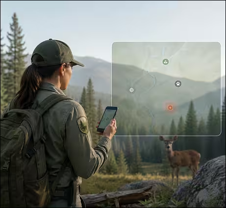
Where Does Wildlife Incident Response Break Down?
Built for forest departments, wildlife agencies, and emergency teams managing incidents across remote, low-connectivity, and multilingual environments.

No Structured Reporting Channel
Citizens rely on informal calls or personal contacts, leaving critical incident details incomplete or unrecorded.

Missing Location Intelligence
Reports are passed without GPS coordinates, forcing rangers to spend time identifying the exact incident location.

Manual Ranger Assignment
Control rooms dispatch field officers through calls and messages without knowing proximity, availability, or zone coverage.

Limited Field Connectivity
Rangers working in forest areas cannot depend on stable mobile data for navigation, updates, or evidence capture.

No Real-Time Operational View
Administrators lack a live map of active, assigned, escalated, and resolved incidents across forest divisions.

Weak Audit and Follow-Up
Verbal workflows make it difficult to track response time, evidence, resolution status, SLA breaches, or citizen feedback.
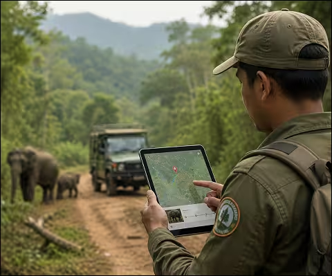
How Forest E2E Management System Works
A five-layer architecture moves incidents from citizen reporting to field response, live dispatch, and final resolution.
- Captures incident details
- Assigns the nearest ranger
- Tracks field response
Improve response speed, strengthen coordination, and manage every forest incident from reporting to final closure.
Field Capture
Receive incidents through a citizen web app, Hindi IVR helpline, SOS alert, mobile form, and live GPS capture.
AI and Telephony
Use voice routing, speech processing, and language models to extract location, animal type, condition, and incident context from natural Hindi speech.
Geospatial Data Store
Store incidents, officers, and reports directly in ArcGIS Feature Services with native spatial queries and live map updates.
Real-Time Dispatch
Broadcast new incidents instantly, auto-assign the nearest ranger, update maps in real time, and keep administrator views synchronized.
Multi-Role Frontend
Provide separate, role-based experiences for citizens, rangers, and control-room administrators from one shared platform.
Field Response Management
Enable rangers to navigate, update status, upload evidence, and work through low-connectivity or offline conditions.
Forest E2E Management System Use Cases
Coordinate field response wherever incidents require fast reporting, geospatial routing, multilingual access, and real-time operational control.

Wildlife Incident Management
Manage injured wildlife, human-wildlife conflict, stray animal reports, rescue requests, and emergency intervention.

Forest Department Operations
Support ranger dispatch, patrol coordination, evidence collection, incident tracking, and audit compliance.

Emergency Field Response
Coordinate government or public-sector field teams where location, routing, and response time are critical.

Rural Citizen Reporting
Give citizens in low-connectivity areas a phone-based reporting channel that does not depend on smartphone access.

Multi-Division Command Centres
Provide administrators with cross-district visibility, workload monitoring, ranger tracking, and SLA performance views.
FAQs
Get answers to common questions about wildlife incident reporting, ranger dispatch, ArcGIS tracking, and offline field operations. Learn how the system helps forest departments coordinate faster responses and manage human-wildlife conflict. Explore how every incident is tracked from citizen report to final resolution.
What is a Wildlife Incident Response System?
A Wildlife Incident Response System helps forest departments manage reports involving injured animals, human-wildlife conflict, rescue requests, and emergency interventions. It connects citizen reporting, ranger dispatch, geospatial incident tracking, field updates, and case closure in one workflow.
How does Hindi AI Voice Reporting work?
Hindi AI Voice Reporting allows citizens to describe wildlife incidents in natural speech over a phone call. The system extracts details such as location, animal type, condition, urgency, and incident context, then creates a structured digital case for further action.
How does ArcGIS Native Incident Management improve response accuracy?
ArcGIS Native Incident Management creates each case as a geospatial incident record from the moment it is reported. This supports GPS-based incident reporting, live incident maps, ranger navigation, forest division monitoring, and more accurate field coordination.
How is the nearest ranger assigned to an incident?
The Nearest Ranger Auto Assignment capability uses ranger location, distance, zone, availability, species expertise, and incident priority to identify the most suitable officer. This automated ranger dispatch reduces manual coordination and improves response time.
Can forest rangers use the system without stable internet access?
Yes. The Offline First Field Application stores recent assignments and critical case information on the ranger’s device. Rangers can access incident details, navigate routes, collect field evidence, and update status in low-connectivity areas before synchronizing later.
How does the system support Human Wildlife Conflict Management?
The Human Wildlife Conflict Management workflow helps teams record, prioritize, assign, track, and resolve cases involving animal intrusion, crop damage, livestock attacks, injured wildlife, and public safety risks. It also maintains a complete incident lifecycle and escalation history.
What can administrators monitor from the command center?
The Real Time Command Center Visibility dashboard shows active incidents, ranger locations, assignment status, SLA monitoring, escalations, response time tracking, and resolved cases. It provides forest control rooms with one live operational view across districts or divisions.
Does the platform maintain a complete audit trail?
Yes. The End to End Digital Audit Trail records incident creation, ranger assignment, navigation, status changes, photos, field evidence, escalation actions, resolution notes, and citizen feedback. This improves accountability, compliance, and incident resolution tracking.
Who can use the Forest Department Operations Software?
The Forest Department Operations Software is designed for citizens, forest rangers, control-room administrators, wildlife rescue teams, patrol teams, and district-level officials. Role-based access gives each user the tools needed for reporting, dispatch, field response, and monitoring.
Can the platform manage incidents across multiple forest divisions?
Yes. The system supports multi-division forest operations through geospatial wildlife incident tracking, ranger location tracking, live incident maps, forest incident analytics, and centralized reporting. Administrators can monitor workload, response performance, and incident trends across multiple regions.

successive Advantage
We design and engineer AI-enabled solutions that elevate customer experience and help enterprises accelerate growth through scalable, technology-driven innovation.